In this issue:
September 2022
Currents: Victories and Threats
Twin Tunnel(s) Déjà Vu
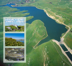
Late last month (July) the California Department of Water Resources (DWR) released its long-awaited environmental impact report (EIR) for the “Single Under-the-Delta Tunnel.” It reflects Governor Newsom’s desire to create his version of Governor Jerry Brown II’s “Twin Tunnels” proposal to transport Sacramento River water to the State Water Project contractors (and perhaps others) in areas south of the San Joaquin/Sacramento River Bay/Delta.
Of course, this Jerry Brown/Newsom idea was part of Governor Pat Brown’s 1950s/60s-era deferred Peripheral Canal idea that was picked up by Governor Jerry Brown I way back in Jerry’s first term as Governor.
Governor Newsom’s “new” proposal is for a single 40-foot diameter tunnel (rather than two tunnels of the same size). From press accounts, the downsizing moves the proposed capacity moves from 9,000 cfs to 6,000 cfs. The tunnel alignment is moved east. In addition, the federal contractors and the U.S. Bureau of Reclamation are not part of (so far) the Tunnel project. Neither are all of the state water contractors. Apparently, the high costs of Tunnel water are discouraging some potential customers.
There are, of course, many issues to tease apart and comment on in the upcoming draft EIR comment period (ending October 27) — and to discuss in the public sphere. Click here to view the Report (and DWR’s spin) on DWR’s website.

But of direct concern to many Friends of the River supporters is the perhaps-deliberately seldom-discussed implication of loosening the constraints on Delta diversions (a major reason for the Tunnel proposal). The Tunnel makes new north-of-Delta reservoir projects more attractive to south-state interests, including dams and diversions originally conceived by State Water Project and federal Central Valley Project planners in the 1940s, 50s and 60s. This was demonstrated by former Metropolitan Water District of Southern California General Manager (MWD) Jeff Kightlinger in his famous comments that his support of Sites Reservoir was dependent on his confidence that the Tunnel(s) project would be built.
And famously, the purpose of the planned conversions of California’s now wild & scenic north coast rivers from the Eel to the Klamath into back-to-back reservoirs was to deliver this water through tunnels into the inner Coast Range, into the Sacramento River, and across the Delta to the south state. Indeed, half the supply for the State Water Project signed contracts came from damming the Eel River — those full delivery “obligations” impossible (for now) by the 1973 and 1982 wild and scenic river designations of this and other north coast rivers.
The Tunnels would also tend to increase the time under which northern California rivers and reservoirs would be available for diversion by south-state interests, drawing down these reservoirs to the detriment of north state fisheries and water supply reliability.
The Department of Water Resources is not proposing to mitigate these impacts.
They should, however, be aware of them since these issues were discussed in the State Board’s Water Fix point-of-diversion hearings by a team that included Jonas Minton, Deirdre des Jardin, Larry Kolb (retired SF Regional Water Quality Control Board staff), and yours truly (Ron Stork). Their testimony and their exhibits can still be found on the Board’s website.
Trouble on the Colorado
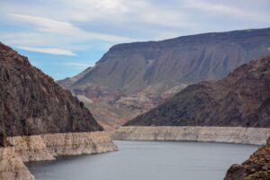
It’s been dry in the multi-state Colorado River basin. Yes, and for many years, really a couple of decades. The press has been full of images of reservoir bathtub rings where “lakes” once stood.
We’ve seen those images before, the Aral Sea in central Asia. The Soviet Union decided to divert the rivers that once flowed into the sea in favor of cotton production. And what the Soviet state wanted, it got. It also got a shrunken sea.
The situation on the Colorado is much the same, but different at the same time. The allocations to the states and Mexico were made in a time of comparative water plenty. But although the reservoirs on the Colorado are huge, eventually, in multi-decade droughts, those allocations will drive the reservoirs to dead pools.
The U.S. Bureau of Reclamation imposed mandatory cuts last year, and more this next year. It has told the states to expect a reduction of 2 to 4 million acre-feet more this next year — and the states better figure out how to do this or Reclamation will do it for them. The states, at this writing, have not reached agreement.
Because of the structure of the existing Colorado River agreements, California has so far escaped the cuts, but the scale of cuts required and the scale of California’s water use in its southern California desert valleys and by the Metropolitan Water District of Southern California (MWD) will mean pruning the golden state supply is coming. (4 million acre-feet is 10% of California’s annual use.)

At the same time of shortage on the Colorado, MWD’s northern California imports from the north state have been restricted dramatically by frequent drought years. No doubt this is a frightening situation for MWD.
The flow in the big canals have been or will be flowing more slowly. When the traditional engineering works of dams and canals are not working, other approaches (engineering or otherwise) must be put into play, and pretending that the droughts (California and Colorado River basin) do not exist is not a solution. Famous Cal Tech physicist and quipster Richard Feynman nailed it when he said, “For a successful technology, reality must take precedence over public relations, for Nature cannot be fooled.”
Good advice.
Filling those proposed new reservoirs
California, the west, and other places around the globe have been facing some major and often multi-year or multi-decade droughts in recent years.
The computers of climate modelers have also been spitting out some disturbing results in their model-worlds with steadily increasing CO2 and other greenhouse gas levels — along with other sunlight energy capture conditions increasing as well. The models show increasing drought conditions for our part of the world, in addition to shorter snow runoff periods and increasing flood magnitudes when they happen.
This makes it harder for the bean counters who try to figure out whether a new reservoir is going to make money — or saddle them with debt that can’t be repaid. For example, one of the smaller boards of directors (unnamed for now) published some minutes recently that suggested the concerns of their bean counters and the pressure from the Sites Project Authority for them to make some further funding commitments. That dilemma is going to be facing many boards of directors.
The San Francisco Chronicle did a story about the request by the California State Water Resources Control Board for the Sites Project Authority to sharpen its pencil on the water availability analysis. The story suggested that a future climate might not be kind to the financial viability for the largest proposed reservoir in many decades. The Authority was quoted that all was well and that they would comply with the board’s request. But…
Of course, financial viability is also really just a question of how many subsidies the project can harvest. The projected $3 billion proposed Sites Reservoir could have a nearly $900 million grant from the state, and nearly that much from the federal government from old funding sources (2014 Proposition 1 and the Water Infrastructure Improvements for the Nation Act of 2016). No doubt state and federal politicians will now also try to find more loose taxpayer change to make it easier for the Sites Project Authority to finance a financially risky project.
Of course, there are also the “investors” who are being sold “space” within the capacity of the project. They’ve pledged some money and no doubt will be asked for more.
The Authority thinks there will be north of a couple hundred thousand acre-feet from the project, a portion of which could be sold to the investors in the project, mostly southern California water districts. Not much water, it won’t be cheap, but maybe the bean counters down in the south state are less price sensitive. And if Providence does not provide the water, maybe they might wonder what “space” is worth.
Strange to report good news, but there’s some good news on the Klamath

Droughts are rough on the Klamath River watershed. This year, there was a destructive fire with fatalities, a summer rain event that washed fire materials into the river, and meager drought flows that have hurt fish stocks.
But out of Washington D.C. came some good news. On August 26, The Federal Energy Regulatory Commission (FERC) (after a wrong turn by river advocates to get the Congress in the decision-making role instead of FERC) released FERC’s final environmental impact statement (EIS) with a preferred alternative to remove four Klamath River dams (J.C. Boyle, Copco 1 & 2, and Iron Gate). The project would largely be paid for by the ratepayers of PacifiCorp, backed up by California Proposition 1 bonds, and again backed up by the states of California and Oregon.
The Klamath River Renewal Corporation (they’ll remove the dams and fix up the place afterwards) and the states of California and Oregon will become the co-licensees of the project for the purpose of removal of the dams.
The removal of these dams will open up miles and miles of the river and some tributaries to unimpeded access by salmon and steelhead trout and other migratory fish — essential river and stream miles so they can complete their life cycle. Poor water quality conditions for fish and humans alike from harmful algal blooms in the reservoirs are expected to improve.
The dam and reservoir removals will not solve all the problems in the watershed: agricultural diversions in some upstream California tributaries and in the U.S. Bureau of Reclamation’s high desert Klamath Irrigation Project remain troubling and only partially addressed. But progress is often incremental, and this project would be the largest dam removal project of this kind in the U.S. Not a bad day’s work.
Also of interest, the target dams and reservoirs are either upstream or intermingled with state and federal Klamath River wild and scenic river segments in both California and Oregon.
FERC’s EIS sets the stage for final Commission action to get the removals started, so stay tuned.
Ecological Importance of Floods
by Keiko Mertz, Policy Director
The new water year starts October 1, and the month of October is a prime time to think about flood preparedness. In fact, the California Department of Water Resources (DWR) has designated October 22-29 as California Flood Preparedness Week.

The California Central Valley was historically a vast floodplain – oft referred to as an “inland sea” – for the numerous rivers spilling out of the Sierra Nevada range. Flooding is endemic to the Central Valley, in other words, flooding is native to the region. Flooding is a natural occurrence and has many benefits for the environment. FOR is active in advocating for flood management solutions that protect and restore rivers and their surrounding lands. There are many strategies to prevent damage from catastrophic floods, and additional dams need not be part of the equation. Floodplains can provide many benefits to the environment and society, during flood and drought, including:
- Keeping communities safe by giving water room to flow.
- Providing conditions to farm certain crops, such as rice.
- Providing excellent fish and wildlife habitat, and creating a food source that supports wildlife throughout the Delta.
- Recharging groundwater, which supplies 85% of California drinking water, and 40% of overall water demand.
- Saving money through the resilient and lasting solutions and preventing catastrophic damage.
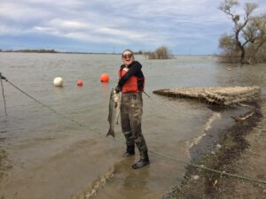
FOR and our partners recently penned a letter to the legislature during the recent budget deliberations requesting additional funding for multi-benefit flood management projects.
As the climate extremes continue to swing more dramatically from drought to flood, protecting our rivers from unnecessary dams and reservoirs requires commitment to show up and advocate for multi-benefit, nature-based solutions that will build resilience for us all.
October Wild and Scenic River Anniversaries
by Ron Stork, Senior Policy Advocate

October is a consequential month for wild & scenic river anniversaries. One might have guessed that because the U.S. Congress calendars can show them close to or at adjournment — at least in election years.
National Wild & Scenic Rivers Act, October 2, 1968 — Well, this is a big one, the 54th anniversary of the National Wild & Scenic Rivers Act itself. This was the Johnson Administration, the heir to both the New Deal (Johnson called his version “the Great Society”), including its dam-building programs among others, and a growing environmental movement that cared about such things.
Books could be written about how the founding act of this country’s wild & river system (Tim Palmer has written perhaps at least three that touch on the subject, all of which belong on your bookshelves), but it’s fair to say that Johnson’s Department of the Interior and important and politically savvy Congressional leaders of both houses made the political deals (no doubt some regrettable) necessary to create the system.
A good anniversary to celebrate none the less.
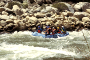
Middle Fork Feather, also October 2, 1968 — This was one of the eight (or twelve, depending on how you count them) “instant” founding rivers designated in the original National Wild & Scenic Rivers Act. These rivers were distributed throughout the country — and had Senators and Congressmen willing to support (or not oppose) their designations. Interestingly, the designation of the Middle Fork Feather River had been opposed by the Army Corps of Engineers, the U.S. Bureau of Reclamation, the Federal Power Commission (now the Federal Energy Regulatory Commission, FERC), and the Soil Conservation Service (now the Natural Resources and Conservation Service). As Tim Palmer says, Johnson signed the bill anyway.
This river was designated as the “the entire Middle Fork,” but today the designated reach of the river extends from Oroville Reservoir (elevation 901 feet) to Beckwourth, the upstream end a clarification of the somewhat ambiguous nature of the meadowy upper parts of this river. Stay tuned to see if the California Department of Water Resources proposes to expand Oroville Reservoir in response to FERC’s recent instruction to figure out how they intend to deal with at least some of the ongoing spillway deficiencies associated with Oroville Dam.
River reaches “saved” a half century ago may become the responsibilities of later generations to protect once again.
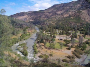
Cache Creek, October 6, 2005 — Designation of parts of Cache Creek was a labor of love by City of Davis-based environmentalists, including former Friends of the River Wild Heritage Campaign Director Bob Schneider, and Friends of the River’s Steve Evans. California Assembly-member Lois Wolk (D-Davis) was the hard-working champion who helped shepherd the state wild & scenic river designation bill through the legislature. The bill took some hits, and some unfortunate compromises were made (hopefully not to be repeated, but hopes sometimes don’t turn out well), but wild & scenic river bills ain’t easy to get through the legislature. Governor Schwarzenegger did the honors in signing the bill into law.
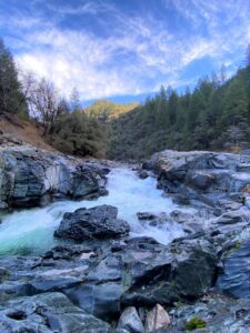
South Fork Yuba, October 10, 1999 — This one was a high-drama affair. The South Yuba Citizens League had been preparing for this since its inception during the threatened “small hydro” dam boom of the 1970s and early 1980s. Fortunately, SYRCL was in it for the long game, and eventually elections have consequences. A Nevada County Board of Supervisors had been elected with a majority in favor of the designation of much of the South Fork of the Yuba River as a component of the state wild and scenic river system.
1999 was also a year after the 1998 record high water, with its huge levee break on the left bank of the Feather River downstream of the Yuba River confluence. In response, the Yuba County Water Agency was inclined to keep all their flood-control operations open — including more dams on the South Fork. The Nevada County board was alarmed by that, and some were prepared to do the work in the state capitol to remove that threat (Supervisor Izzy Martin gets a gold star there).
SYRCL, Friends of the River’s Steve Evans, and State Senate Pro Tem John Burton chief of staff and former FOR board member Alison Harvey poured oodles of time into the effort. The bill passed by one vote.
But to do that, it needed an agreement among the environmental parties, Yuba County Water Agency, and Governor Gray Davis to work together to address flood risks in Yuba County. Without that, the bill could not have squeaked through the legislature and won the Governor’s signature. A successful state floodwater management bond (Proposition 70) emerged, and the mutual commitments among the environmental groups and the Agency to work together on meeting the area’s floodwater management challenges continues today.
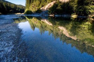
Black Butte River, October 17, 2006 — Way back in 1988, Friends of the River made one of its best hiring decisions: bringing Steve Evans on board to work full time to work with agencies, the legislature, the Congress, and the public to create a wild & scenic river designation machine. With advances and setbacks, over the years, Steve was able to create that well-oiled and often effective machine.
The Black Butte River is a tributary of the Middle Fork Eel, portions of the Eel being an original state wild & scenic river in 1973 and a national wild & scenic river in 1982. The 2006 legislation, sponsored by Rep. Mike Thompson (D-Helena) and California U.S. Senators Boxer and Feinstein, quietly added the Black Butte River to the national wild & scenic rivers system with the signature of George Herbert Walker Bush.
Well-oiled machines need not be noisy.
“Lower ” Merced River, October 23, 1992 — This eight-mile stretch of the Merced River reaches from the intersection of state highway 140 and the Merced River downstream to “Lake” McClure Reservoir. There are too many tales about this little effort to count. Some day, before the campaigners pass or reach their dotage, I should write a book about it.
 Suffice it to say, Representative Tony Coehlo (D-Dos Palos) and California U.S. Senators Wilson and Cranston thought they passed this bill in 1990 — but in the end-of-session confusion, they ended up passing slightly different versions of the same bill. For those of you paying attention in high school civics, that means the bill failed.
In 1992, Rep. Coelho was gone, replaced by Rep Gary Condit (D-Modesto), and Republican Senator Wilson was now Governor with John Seymour appointed by Governor Wilson to fill his vacant seat until the November 1992 election. Mariposa County Supervisor Art Bagget and Tony Coelho persuaded Gary Condit to re-sponsor the bill and Governor Wilson and his staff now working for Senator Seymour helped to get Senator Seymour on board.
The Republican Senate Committee staff helped considerably (those were kinder and gentler days) to help sort out political issues of the day. Clarifying amendments were added at the requests of Mariposa County and the Merced Irrigation District. The U.S. Bureau of Land Management (BLM), which had already completed its wild & scenic river management plan in anticipation of bill passage in 1990, sought and received bill language that withdrew all of the Forest Service and Bureau of Land Management lands along the river from new mining claims under the 1872 Mining Act. The designation language strengthened the effect of the designation rather than weakened it. Nice job, BLM.
It helped considerably that I spent the summer and early fall in Washington DC (with hordes of visiting river-lovers from California) defeating Auburn dam. That gave me a direct and convenient perch to do all the things necessary to help shepherd the Merced bill to completion and signature by President Ronald Reagan.
I have to say that I remember the late afternoon walk through the U.S. Capitol grounds toward my temporary quarters on Constitution Avenue after I have confirmed the passage of the bill. The carefully tended grounds with trees native to many parts of the country were suffused with the low-angle light of an early autumn late afternoon, and I was saying to myself, “Well done, Ron. It’s time to go home to Sacramento.” And a few days later, I did.
Alas, rest does not always come. The House of Representatives, under Republican leadership in 2012 and 2014, voted to prune off the lower end of this river reach to put a reservoir there. They may be back next year. If so, others with younger legs may have to pull the DC duty, but don’t worry, I and others not in DC will do all we can to help.
Hello from Keiko
by Keiko Mertz, Policy Director

I recently joined Friends of the River as the new Policy Director last month. I am so excited to be on this team and working for an organization with such an extensive resume of accomplishments! Here are some things I think you should know about me:
- I am a dedicated environmentalist: I have about 10 years of educational and work experience in this industry. My background is science and wildlife biology, and in more recent years I earned a Master’s degree in Environmental Policy and Management. I am passionate about this work and have committed my career to this cause.
- Fish passage keeps me up at night: I worked in Central Valley fisheries from 2016-2018, giving me an intimate understanding of the issues plaguing our native fishes and waterways. Our precious anadromous fish (i.e. salmon, steelhead, sturgeon) are in grave danger of extinction if they can’t access historic habitat behind large concrete dams.
- I am an experienced river advocate: I spent the last year working to protect the Yuba River – a beautiful river that flows among granite boulders, from the High Sierra to the Central Valley. The South Fork of the Yuba even has a Wild and Scenic state designation. In this role, I organized grassroots efforts to stop a proposed dam, promote sustainable water management, and educate the community. I am thrilled to expand this work to a statewide reach.
- I am skilled at distilling science and technical information for broad audiences: I’ve been told it’s my superpower! You can expect to see succinct summaries and breakdowns of FOR’s policy work.
 To get to know me a little better, here are some items on my bucket list and my favorite adventures.
Bucket List:
-
-
-
-
-
-
-
-
-
- Fly in a hot air balloon
- Visit Portugal
- Become a certified whitewater rafting guide
-
-
-
-
-
-
-
-
Favorite Adventures:
-
-
-
-
-
-
-
-
-
- Rafting the Grand Canyon
- Weekend trip to Sedona, Arizon
-
-
-
-
-
-
-
-
I’d love to get to know you, too! Please feel free to email me something on your bucket list, or one of your favorite adventures at keiko@friendsoftheriver.org (please include photos!).
Nice to meet you all!
P.S. Tippy, Mac, and Penny would also like to say “hello!”

River Advocate Back Issues
September 2022
Back Issues of Headwaters Newsletter

