by Steve Evans, Wild Rivers Consultant
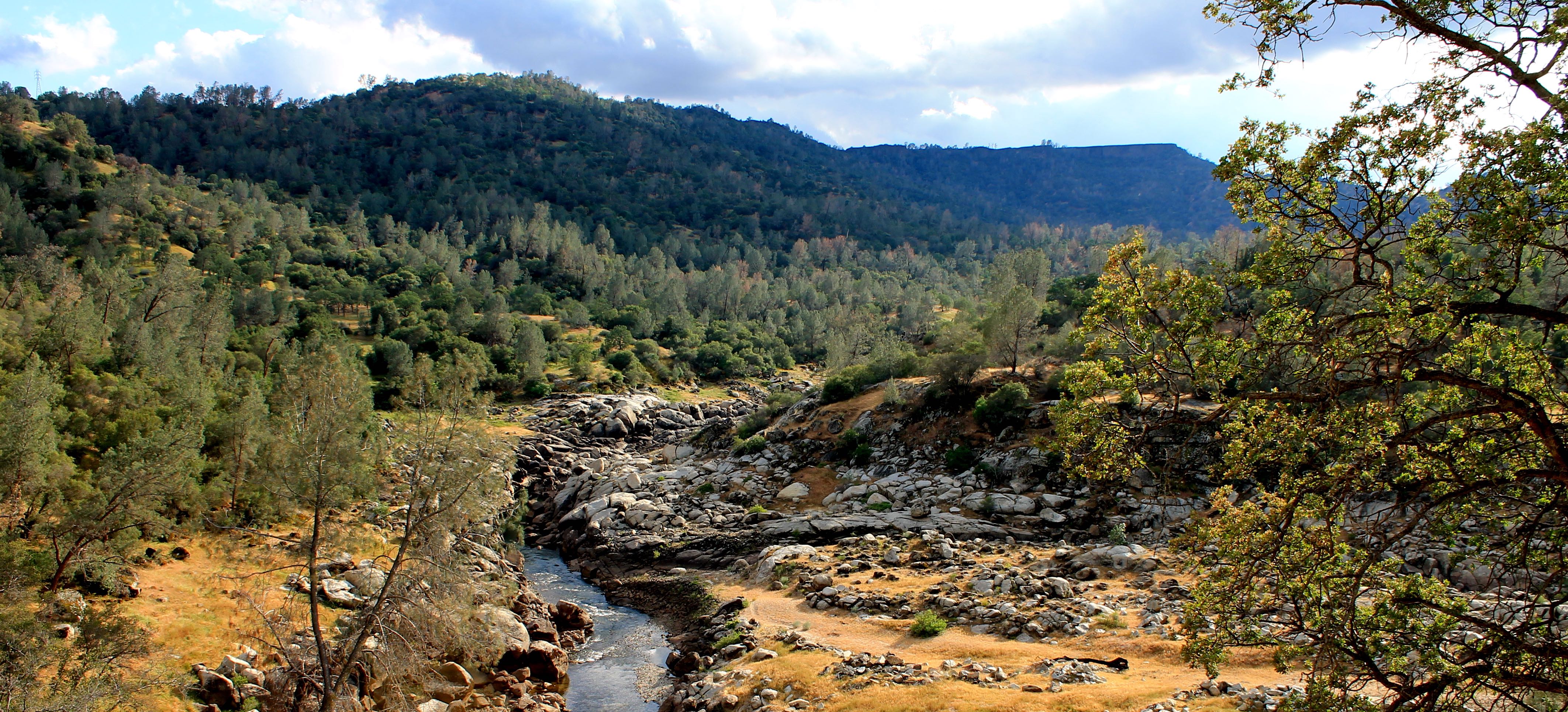
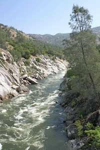
The San Joaquin River flows through a spectacular gorge in the Sierra Nevada foothills northeast of Fresno. More than 6,000 acres of the Gorge is public land managed by the Bureau of Land Management (BLM). An extensive trail system provides access to the Gorge for hikers, mountain bikers, equestrians, hunters, wildlife and wildflower aficionados, and class IV-V whitewater kayakers. One of the few publicly owned recreation areas in the lower foothills of Fresno and Madera Counties, the Gorge also features three campgrounds, an outdoor environmental education classroom, and a small natural history museum. The Gorge is a popular outdoor recreation destination for more than 85,000 visitors annually.
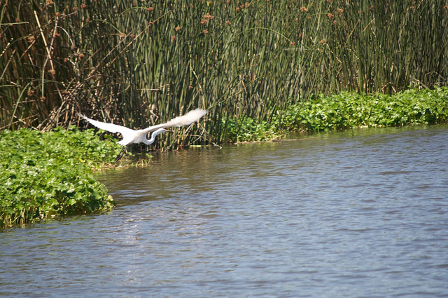
BLM’s San Joaquin River Gorge Management Area is located just upstream of the existing Millerton Reservoir and Friant Dam. A short 45-minute drive from Fresno via Highway 168 and through the small town of Auberry brings visitors to this delightful area. Granite rock outcrops punctuate the oak woodlands, meadows, and chaparral of the Gorge, which is probably best known for its gorgeous spring wildflower display. This habitat supports a wide range of wildlife, including mule deer, bear, mountain lion, waterfowl, and more than 24 sensitive, threatened, or endangered species.
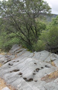
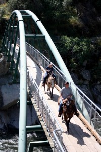
Miles of trails provide access to the Gorge and its surrounding uplands, including the Wu Ki’ Oh National Recreation Trail and a segment of the San Joaquin River Trail proposed for National Recreation Trail designation. Trailhead corrals make the trail system popular with equestrians. Three campgrounds (including walk-in, group, and equestrian campgrounds) provide ideal base camps to explore the area. The Gorge is also rich in Native American culture. Acorn grinding holes are common in bedrock outcrops, a reminder of the Dumna and Kechayi Native Americans who once called the Gorge their home.
The outstanding natural and cultural values make the San Joaquin River Gorge a unique outdoor classroom. The BLM and its local partners operate a small natural and cultural history museum in the Gorge, which offers a wide variety of hands-on interactive educational programs for K-12 students, including guided nature walks, geology, history, and Native American basketry, games, and stories. To learn more about the BLM’s San Joaquin River Gorge area, visit: http://www.blm.gov/ca/st/en/fo/bakersfield/Programs/Recreation_opportunities/SJRG_SRMA.html.
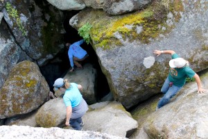
One of the relatively unknown natural values of the San Joaquin River Gorge is the Millerton Cave system. Considered by spelunkers to be a unique cave system, the Millerton Cave is the world’s most notable example of a cave carved in granite bedrock. Almost a mile long, the cave system has been sculpted over thousands of years by a year-round flowing underground stream. Besides its scientific values, the cave offers unique recreational opportunities to trained spelunkers.
Because of the Gorge’s unique and nationally significant values, the BLM in 2012 recommended eight miles of the Gorge for protection as a National Wild & Scenic River. Wild & Scenic protection of the San Joaquin River Gorge would preserve the free flowing character of only remaining undammed segment of the San Joaquin River in the Sierra Nevada foothills. It would also protect the Gorge’s specific outstandingly remarkable scenic, cultural, and wildlife values. First and foremost, Wild & Scenic River designation of the Gorge would protect it from the proposed Temperance Flat Dam, which threatens to drown the river’s unique natural and cultural values under a reservoir.
The BLM’s fellow-federal agency, the Bureau of Reclamation, is currently studying the proposed Temperance Flat Dam, which would be located in the San Joaquin River Gorge, just upstream of the existing Millerton Reservoir and Friant Dam. If constructed, the Temperance Flat Dam would destroy or degrade virtually all the recreation, scenic, and cultural values of the public lands along the river and within the Gorge.
Ironically, the proposed dam’s potential contribution to the state’s water supply is miniscule. The truth is the Temperance Flat Dam (Read the TFD Fact Sheet 3-2-2016) is an expensive and ineffective solution to the state’s water needs. Studies prove that dams are the most expensive and least reliable water options in the state, and that’s not calculating the loss of such beautiful natural areas like the San Joaquin River Gorge.
How To Get There: From Fresno, drive 31 miles northeast on Highway 168, past the town of Prather, to the Auberry Road intersection. Turn left on Auberry Road and drive 5 miles to the town of Auberry. Drive through Auberry and veer left on Powerhouse Road (also known as New Auberry Road). Drive 1.8 miles to the Smalley Road intersection, turn left. Proceed down narrow but paved Smalley Road to BLM’s San Joaquin Gorge Area. The trailhead to the river is located in the campground. It is a relatively easy one-mile walk through oak woodlands down to the trail bridge, which provides breath-taking views of the San Joaquin River Gorge.
For up to date information about the Gorge and the status of its roads and trails, contact the BLM’s San Joaquin River Gorge Manager, Tracy Rowland, at (559) 855-3492, email: trowland@ca.blm.gov.
Friends of the River is organizing a weekend camping trip this spring (April 30 – May 1) in the Gorge for our members, donors, and anyone interested in helping preserve this magnificent river. Please contact us for the date and more information at info@friendsoftheriver.org.